Urban Planning Data Analytics: How Cities Use Data in 2026

Last Updated: March 22, 2026
Key Takeaways
- Urban planning data analytics integrates IoT sensors, satellite imagery, and traffic data into unified intelligence
- Real-time predictive modeling helps planners optimize transportation, reduce emissions, and manage infrastructure
- The global market for urban planning software reached $117.74B in 2026, growing at 14.1% annually
- Most cities still operate with fragmented data systems; unified enterprise platforms deliver measurable ROI
- AI-powered satellite analytics and edge computing enable near real-time urban insights
What Is Urban Planning Data Analytics?
Urban planning data analytics is the systematic process of collecting, processing, and analyzing data from cities to inform smarter design and operational decisions. This includes information from IoT sensors embedded in infrastructure, satellite imagery capturing land use patterns, traffic flow data, public records, and citizen feedback systems. By applying mathematics, statistics, and computer programming to this raw urban data, planners extract actionable insights that drive measurable improvements in efficiency, sustainability, and quality of life.
The need for this approach has never been more urgent. Cities worldwide are experiencing unprecedented growth and complexity. The infrastructure stress is real: congested transit systems, aging water networks, energy inefficiency, and uneven development patterns strain resources and degrade livability. Decisions made without solid data often result in costly mistakes, missed opportunities, and solutions that don't actually address root problems.

The market reflects this growing recognition. The urban planning software and services sector was valued at $117.74 billion in 2026, with projections to reach $260.72 billion by 2032, representing a 14.1% compound annual growth rate. This expansion signals that cities and organizations are investing seriously in data-driven approaches. As urbanization pressures intensify globally, data analytics plays an essential role in helping urban planners create more efficient, cleaner, and safer cities. The transition from fragmented data silos to unified city intelligence isn't optional anymore; it's fundamental to modern urban management.
The Evolution of Urban Planning: From Guesswork to Data-Driven Design
For decades, urban planners worked with incomplete puzzles. They relied on census data collected every ten years, traffic counts from a handful of intersections, and educated guesses about where growth would happen next. The result: cities that often felt reactive rather than intentional, with infrastructure built for yesterday's problems instead of tomorrow's needs.
Today, that's changed fundamentally. Cities now have access to continuous streams of information that paint a real-time picture of urban life. Smartphones and IoT devices embedded throughout city infrastructure generate massive datasets on movement patterns, energy consumption, and public space usage. Satellite imagery captures urban change at scale, while social media and mobile apps reveal how residents actually experience their neighborhoods.
The shift from static to dynamic intelligence has proven transformative. Rather than proposing a development and hoping it works, planners can now run predictive simulations showing exactly how a new transit line or zoning change will ripple through the system. They see traffic patterns before they become congestion crises; they identify environmental vulnerabilities before they become disasters.
What makes this truly powerful is the speed. AI-powered satellite analytics combined with edge computing filters massive datasets in real-time, eliminating the lag between observation and insight. Where planners once waited months for analysis, they now make decisions on current information. AI-powered space operations are offering planners a view of urban life no one had two decades ago, revealing patterns invisible to traditional methods.
This evolution isn't just about having better information. It's about treating cities as living systems that require constant, intelligent monitoring. The guesswork era is over.
Core Applications: How Urban Planners Use Data Analytics Today
Urban planners today are moving far beyond intuition and spreadsheets. Real-time data analytics now drives decisions that shape how millions of people move, live, and interact with their cities.
Transportation optimization stands as one of the most visible applications. Cities deploy sensors and connected devices to monitor traffic patterns continuously, identifying bottlenecks before congestion becomes severe. Predictive models forecast demand spikes during rush hours or special events, allowing transit agencies to adjust bus routes and train schedules dynamically. The result: reduced commute times, lower emissions, and better resource allocation for public transit systems operating on tight budgets.
Infrastructure management has equally transformed. Rather than waiting for a bridge to fail or a water main to burst, cities now use predictive analytics to monitor the health of critical assets. Sensors embedded in roads, water towers, and power stations transmit continuous data, alerting maintenance teams to deterioration before it becomes catastrophic. This shift from reactive repairs to preventive maintenance extends asset lifespans and prevents costly emergency interventions.

Environmental monitoring has become granular and actionable. Air quality sensors deployed across neighborhoods provide real-time pollution data, enabling planners to adjust traffic patterns or industrial operations when needed. Waste management systems use collection data to optimize routes and reduce fuel consumption. Green space planning now relies on spatial analysis to identify where trees and parks would deliver maximum environmental and public health benefits.
Resource allocation, particularly for water and energy, benefits enormously from data-driven insights. Analytics reveal consumption patterns, identify leaks, and forecast future demand, allowing cities to plan infrastructure investments strategically rather than reactively. Public safety applications are equally compelling: crime pattern analysis helps departments deploy resources to high-risk areas, while crowd management systems use real-time data to prevent dangerous situations at events and transit hubs.
The common thread across all these applications is measurable impact. Cities aren't collecting data for its own sake; they're using it to solve problems, save money, and improve daily life for residents.
The Data Unification Challenge: Why Fragmented Systems Fail
Most cities operate like disconnected islands. Your transportation department collects traffic sensor data through one vendor. The utilities team manages water and energy systems through another. Parks and recreation uses a separate platform. Meanwhile, legacy infrastructure systems from a decade ago still run independently, speaking entirely different technical languages.
This fragmentation is the silent killer of urban intelligence. When data lives in isolated silos, you lose the ability to see how systems actually interact. A traffic congestion pattern might correlate with water main breaks or power grid strain, but you'd never know because nobody's looking at all three datasets simultaneously. Decision-making slows to a crawl. Budget allocation becomes guesswork. Strategic initiatives stall while departments wait for IT to manually extract and translate data from incompatible systems.
The root cause is infrastructure chaos. Cities typically collect data from dozens of sources: IoT sensors embedded in streets, satellite imagery, social media feeds, mobile apps, and those older systems that nobody wants to touch because they "still work." Each vendor uses proprietary formats and communication protocols, creating a technological Tower of Babel. Data from different devices tends to be siloed, but cities can find significantly more insight by centralizing all data from multiple devices and legacy systems.
Here's what mature cities understand: unification requires serious infrastructure work. You need robust data integration to pull information from disparate sources. You need governance frameworks to establish who owns what data and how it's used. Quality management becomes essential because garbage data produces garbage decisions. Security and scalability matter because you're handling sensitive information at citywide scale.
The payoff is substantial. Smart city data management platforms unify data to provide a comprehensive operational view, enabling cities to monitor traffic flow, identify congestion patterns, optimize signal timing, and improve public transit reliability. More importantly, cities with mature data management frameworks are better positioned to scale IoT initiatives, adopt AI-driven analytics, and deliver consistent, trusted outcomes across departments.
Your city doesn't need more data. It needs the right data, in one place, accessible to everyone who needs it.
Building Scalable Urban Analytics Infrastructure
Building a scalable urban analytics infrastructure requires connecting disparate data sources into a unified system that can ingest, process, and visualize information in real time. Most cities currently operate with fragmented data silos, where traffic management, utilities, public safety, and planning departments maintain separate systems. Breaking down these barriers starts with robust data ingestion architecture.
Your infrastructure needs to pull data from hundreds of thousands of sources simultaneously: IoT sensors embedded in roads, traffic cameras at intersections, satellite imagery monitoring development, weather stations, and legacy databases housing decades of historical records. Stream processing engines handle this continuous flow, transforming raw signals into actionable insights without the delays that batch processing introduces. The goal is immediate visibility into what's happening across your city right now.
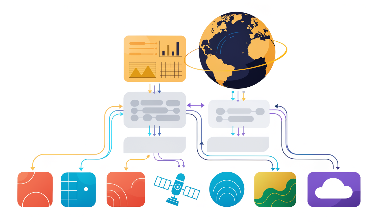
Centralized data lakes organize this diversity into queryable formats. Rather than forcing different data types into rigid schemas, modern architectures preserve raw data while creating standardized views for analysis. Predictive models then forecast traffic congestion patterns, anticipate maintenance failures before they occur, and estimate resource demand across neighborhoods. Edge computing complements this approach, processing data locally at sensors and cameras to reduce latency for time-critical decisions like traffic signal optimization.
Real-time dashboards and 3D geographic visualizations translate technical outputs into decisions planners can act on immediately. But infrastructure means nothing without governance. Research indicates that significant differences in data analytics resources across cities reflect different investment levels and preparedness. Implement strict access controls, encryption standards, and compliance frameworks to protect citizen privacy while enabling cross-departmental collaboration. Cloud platforms provide scalability and flexibility, though hybrid approaches combining cloud storage with edge processing often deliver the best performance and cost efficiency for cities managing sensitive infrastructure data.
Future Trends: What's Next for Urban Planning Analytics in 2026 and Beyond
The next wave of urban planning analytics isn't coming; it's already arriving. Cities in 2026 are moving beyond static datasets toward continuous, intelligent monitoring powered by AI-enabled satellite constellations. Modern satellite systems capture data continuously, giving planners a live view of urban change at scale, with AI embedded directly into space systems for near real-time insights into flooding risks and environmental patterns. This shift transforms how cities respond to challenges, moving from reactive to genuinely predictive.
Edge AI represents another critical evolution. Rather than sending all sensor data to distant servers, intelligence now processes directly on devices and edge infrastructure, delivering instant insights where decisions happen fastest. A traffic sensor detects congestion and adjusts signals in milliseconds. A building system identifies energy waste and corrects it automatically. This distributed approach eliminates latency that once made real-time urban management impossible.
Autonomous systems integration marks the third frontier. Self-driving shuttles, delivery drones, and intelligent infrastructure require analytics platforms that ingest and respond to their continuous streams of operational data. Cities using data to achieve carbon neutrality and climate resilience goals are discovering that autonomous systems, when orchestrated through unified analytics, accelerate progress dramatically.
The sustainability imperative reshapes priorities entirely. Data analytics now focus explicitly on carbon tracking, air quality patterns, and infrastructure resilience. Open data portals and real-time citizen engagement channels transform residents from passive observers into active participants in urban improvement.
Interoperability represents perhaps the most underrated shift. GIS and BIM systems working seamlessly enable comprehensive scenario analysis that was previously fragmented across departments. A proposed development now gets evaluated instantly against traffic flows, utility capacity, environmental impact, and community needs simultaneously.
Cities investing in analytics platforms capable of supporting these evolving technologies today won't scramble to adapt tomorrow. The question isn't whether these trends will arrive, but whether your city's infrastructure can grow with them.
FAQ: Common Questions About Urban Planning Data Analytics
How long does implementation actually take?
Most cities see meaningful results within 6 to 12 months, though this depends heavily on your starting point. If you're working with fragmented legacy systems, expect 12 to 18 months. Quick wins in high-impact areas like traffic management or utility optimization can appear within three to six months, giving leadership confidence to continue investing.
What ROI should we expect?
Real outcomes matter more than percentages. Cities typically see 15 to 30 percent reductions in operational costs, faster emergency response times, and better-informed zoning decisions. The strongest ROI comes from preventing costly mistakes rather than generating revenue. One municipality reduced water main breaks by 40 percent after analyzing break patterns with historical weather data.
How do we handle data privacy?
Start with a governance framework defining who accesses what. Implement role-based access controls, encrypt sensitive datasets, and audit all queries. Anonymize personal information wherever possible. Most cities find that transparent data policies actually build public trust, especially when residents see tangible improvements in services.
Which data sources come first?
Prioritize what causes the most pain or waste: traffic congestion, utility failures, or public safety gaps. Traffic data and permit information typically deliver quick wins because they're already somewhat organized. Build momentum there before tackling messier datasets.
How do we pick a vendor?
Test integration with your existing systems before committing. Scalability matters; your platform should grow with ambitions. Ask about support quality and whether they understand municipal workflows, not just generic analytics. References from similar-sized cities are invaluable.
What skills do we need to hire?
You'll need data engineers for pipeline work, analysts for insights, and GIS specialists for spatial analysis. But your biggest asset is domain expertise: planners and department heads who understand what the data should reveal.
Key Takeaways: Making Urban Planning Data Analytics Work for Your City
The path forward for your city is clear: stop treating data as separate departmental assets and start treating it as unified intelligence. Cities that consolidate transportation, utilities, housing, and environmental data into a single analytical framework make faster decisions, reduce infrastructure costs, and respond to citizen needs in real time rather than months later.
Your immediate priorities should be three-fold. First, audit your current data landscape honestly. Where are your silos? Which departments can't talk to each other? This uncomfortable inventory is your roadmap. Second, invest in governance structures before technology. The best analytics platform fails without clear data ownership, quality standards, and security protocols. Third, demand scalability from day one. Your platform should grow from neighborhood-level insights to city-wide predictive models without expensive overhauls.
The competitive advantage belongs to cities moving now. Real-time traffic analytics reduce congestion; predictive maintenance catches infrastructure failures before they become crises; satellite imagery powered by AI identifies zoning violations and environmental risks automatically. These aren't futuristic concepts. They're operational today in forward-thinking municipalities.
Enterprise analytics platforms deliver measurable ROI when properly implemented: 15-30% reductions in maintenance costs, faster permit processing, improved public safety outcomes. But only if you commit to the fundamentals: unified data, strong governance, and continuous improvement.
Your city's complexity is your opportunity. The municipal leader who transforms fragmented data into strategic intelligence gains a decisive edge in resource allocation, citizen satisfaction, and long-term resilience. The question isn't whether to modernize your analytics capability. It's whether you'll do it this year or watch competitors pull ahead.
Transform Your City's Data into Strategic Intelligence
The infrastructure for unified city intelligence exists right now. The urban planning software market is accelerating, projected to reach USD 260.72 billion by 2032, growing at 14.1% annually, which signals one thing clearly: cities that move fast on data integration will outpace those that don't.
The competitive advantage isn't theoretical anymore. Cities consolidating fragmented data sources are making faster decisions, optimizing resources more effectively, and delivering measurably better outcomes in traffic flow, housing allocation, and sustainability metrics. Your competitors, your neighboring municipalities, your regional peers - they're already evaluating their data infrastructure gaps. The question isn't whether to unify your city's data; it's whether you'll do it this year or next.
Enterprise analytics platforms eliminate the friction that slows planning cycles. Real-time intelligence across transportation, zoning, utilities, and demographics means your planners spend less time hunting data and more time solving problems. This matters because every month of delay is a month your city operates with incomplete information.
Start by auditing your current state. Map where your data lives, which systems can't talk to each other, and what decisions are suffering because of those gaps. Then prioritize ruthlessly. You don't need perfection; you need momentum.
The technology works. The market is moving. The opportunity window is open. The cities that act now will define urban efficiency and livability for the next decade. Your move.
Keep reading

Critical Third Parties: UK Cloud Rule Explained
A Critical Third Party is a provider whose service failure could threaten UK financial stability. The first UK designations are four cloud providers.

Netflix Earnings Put Always-On TV in Focus
Netflix reports Q2 results July 16 after reports it is weighing always-on channels. Arkolith maps NFLX to $284.0B in tracked 13F value.

UK Cloud Watchlist Maps to $4.45T in 13F Value
The UK's first cloud oversight list maps to Microsoft, Alphabet, Amazon and Oracle, which Arkolith tracks across $4.45T of Q1 2026 13F value.